MyGeoVerse Powers World-First Cross-VPS Interoperability Demonstration at ISMAR 2026
XR Masters participated in a world-first cross-VPS interoperability demonstration at IEEE ISMAR 2026 in Bari, Italy, showing how independently developed spatial browsers can discover and display the same location-anchored digital content while using different Visual Positioning Systems.
Held on October 5, 2026, the demonstration brought together MyGeoVerse by XR Masters, using MultiSet VPS, and spARcl, Open AR Cloud’s open-source WebXR spatial browser, using OpenVPS. Both browsers independently displayed the same geospatially anchored 3D content at the correct physical position and orientation through the OGC GeoPose Standard and Open AR Cloud’s Open Spatial Computing Platform (OSCP) protocols.
Sharing Our Experience at the ISMAR Tutorial
The demonstration followed Open AR Cloud’s half-day tutorial, Building Interoperable Location-Based Augmented Reality with the Open AR Cloud. Led by Dr. Gábor Sörös of Nokia Bell Labs, the tutorial brought together researchers, developers, standards contributors, and technology providers to explore the foundations of an open Spatial Web.
Our CEO, Ali C. Hantal, who also serves as Co-President of the Open AR Cloud Association, presented XR Masters’ work with MyGeoVerse and its role in spatial content publishing and interoperable experiences.
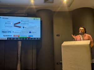
Ali C. Hantal, CEO of XR Masters and Co-President of Open AR Cloud, presenting during the ISMAR 2026 tutorial in Bari, Italy.
One Published Experience, Two Independent VPS Technologies
For the cross-VPS demonstration, a 3D Open AR Cloud logo was published through MyGeoVerse and anchored to a physical location outside The Nicolaus Hotel.
MyGeoVerse served as both the spatial content publishing platform and a native mobile spatial browser, using MultiSet VPS to determine the device’s position and orientation. Independently, spARcl discovered the same published content through OSCP and used OpenVPS for localization.
Although the browsers relied on different VPS technologies and separate spatial maps, they displayed the same content in the same physical location with the correct orientation.
This demonstrates a central principle behind MyGeoVerse: spatial content should be publishable once and accessible through independent applications and localization technologies using common standards.
Watch the Demonstration
Building an Open Spatial Ecosystem Together
This achievement builds on earlier interoperability demonstrations involving MyGeoVerse and spARcl: POI interoperability in Delft in 2024, followed by POI and GeoPose interoperability at Google’s Mountain View campus in 2025. The Bari demonstration extended that work across two independent VPS providers.
For XR Masters, this progress supports our vision of museums, campuses, cultural heritage sites, tourism destinations, and other venues publishing spatial experiences that can reach visitors across compatible browsers and positioning systems.
We thank Dr. Gábor Sörös and the Open AR Cloud community, along with the teams from MultiSet, Augmented City, Immersal, and Nokia Bell Labs, for their contributions to the tutorial and demonstration program. Special thanks to Katherina Ufnarovskaia and the Augmented City team for their support and hospitality in Bari.
Read the Full Story
For the technical architecture, earlier milestones, and the broader Open AR Cloud ecosystem, read the full article by Ali C. Hantal, published on OARC’s Medium publication: